Study Overview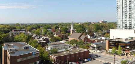
As the western entry point into Downtown Brampton and the Central Area, there has been a considerable amount of sustained pressure within the Queen Street West area for new development and the redevelopment of existing uses. This pressure is expected to continue, especially as part of the area is included in the Downtown Brampton Urban Growth Centre. The City has undertaken a land use study for the Queen Street West area to review and make recommendations on changes to the planning and urban design policy framework to better guide redevelopment within the area.
Study Area
The Queen Street West study area includes the lands straddling Queen Street between George Street and McLaughlin Road. The northern boundary is the CN rail line and Fletcher’s Creek. The southern boundary is Wellington Street, Fleming Avenue and the Orangeville rail line.
A map of the study area can be found here.
Study Organization
The Queen Street West land use study is intended to be carried out in three phases:
Phase 1: The intent of Phase 1 is to review the current land use and policy framework, and identify areas where land use change is considered appropriate and those where it is not.
Phase 2: Phase 2 builds on the Phase 1 work by making recommendations on how the study area should develop in the future. The key elements of Phase 2 are:
- A vision statement and urban structure plan describing the preferred future for the study area and a series of goals and objectives to outline how the vision would be implemented
- A more detailed vision for each of the “change” areas identified in Phase 1 and urban design principles to guide the form of future development within them.
- Recommended policy and regulatory changes to implement the vision for development in the “change” areas and to strengthen the protection of areas identified as stable residential neighbourhoods.
A key recommendation is the establishment of a Development Permit System (DPS) for part of the study area. The DPS is a new tool under the Ontario Planning Act that is intended to establish a clear vision for how the area will develop in the future and simplify the approval process for proposals that support the vision.
Phase 3: Phase 3 will focus on implementing the recommendations from Phase 2, including the preparation of a Development Permit System by-law, and revisions to the Official Plan and Zoning By-law regulations.
Public Input
Phase 1: Two Public Information Sessions were held to present the preliminary Phase 1 findings. The first session was held on November 9, 2009. In 2010, the City decided to include additional lands in the study area. These lands are located north of the original study area between Nelson Street / Denison Avenue and the Canadian National Rail line. A second Public Information Session was held to present the preliminary Phase 1 findings for this area and as an update for the original study area.
The following are the materials presented at both sessions:
Phase 2: A third Public Information Session was held on June 20, 2013 to present the draft Phase 2 findings.
To view the presentation materials, click here.
Phase 3: There will be future Public Information Sessions and other opportunities to provide input during Phase 3 of the project.
